

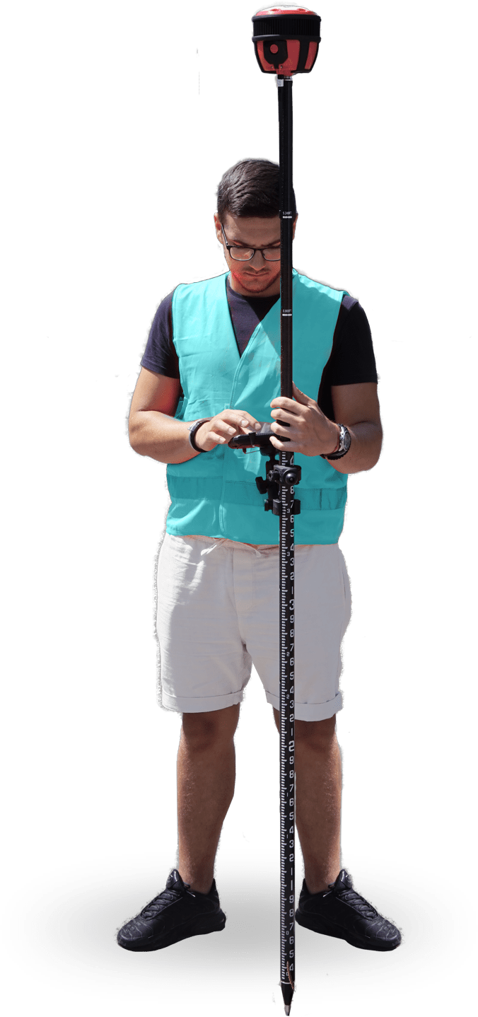
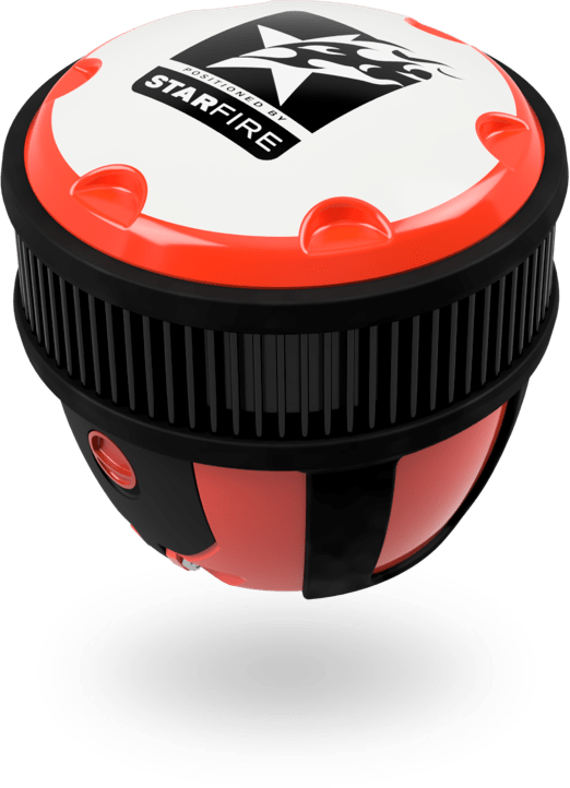
Developed and produced in Switzerland, AIOS GNSS is a multi-constellation, full-featured GNSS receiver, with worldwide centimetric accuracy and a lifetime StarFire license
European Global Navigation Satellite System
The AIOS GNSS is one of the topmost when it comes to the various types of global navigation satellite systems available throughout the world. A full-featured GNSS; it tracks all major positioning systems satellites. AIOS GNSS always produces accurate results up to 1 cm accuracy using RTK. Even in remote and difficult areas, the included lifetime Starfire license, provides an accuracy of 5 cm, anywhere on the planet, without a base station or correction signal.
To complete your tasks with consistency, we recommend our sophisticated satellite based navigation system. Intelligent and reliable, it is all you need in a GNSS and more!

Key Features
Our global navigation satellite systems enable smoothly-transitioning workflows that you will surely grow to rely on! The AIOS GNSS can enhance your productivity while simplifying your work with the following features:

Uses GNSS Onyx™ core that generates superior results in difficult environments

Built in Arm Processor running on Linux enabling automatization for data log, running user programs and cloud communication

The rugged, waterproof and shockproof design

UHF, GSM, WiFi and Bluetooth connectivity

Hot swappable batteries ensures continuous operations
About Starfire
The StarFireTM Network is a global system for the distribution of SBAS corrections that gives users the ability to measure their position anywhere in the world with exceptional reliability and unprecedented accuracy of better than 5 cm (2 inches).
Because the SBAS corrections are broadcast via INMARSAT geo-stationary satellites, users need no local reference stations or post processing to get this exceptional accuracy.
Furthermore, the same accuracy is available virtually anywhere on the Earth’s surface, on land or sea, with a look angle of 10° to the satellite, due to the worldwide coverage of these geo-stationary satellites.
Domains of applications
Aside from mapping any type of land area, our GPS equipment for land measurement with RTK accuracy can help you get a grip on land boundaries and drainage pipes by indicating the precise position or measurements for them. Other applications include:
Land survey
UAV Aerial
Photogrammetry and
Lidar
GIS and
asset mapping
Machine
control
Unmanned
Vehicles
Government
& Military
Product specifications
General Specifications
- StarFire guarantees a standalone worldwide accuracy of five (5) centimeters
- L1C/A, L2P, L2C, L5, G1C/A, G2P, G2 C/A, B1, B2, E1, E5A, E5B
- Ultra RTK (up to 40km baseline)
- High sensitivity/low signal level tracking
- Writing your own application for the GNSS
- Rugged, waterproof and shock proof design coupled with hot swappable batteries.
- Designed for all day use.
Technical Specifications
- Includes – 2-Batteries, Battery charger
- 4GB removable SD card
- UHF Radio transceiver,
- Serial and USB cables
- AC/DC power cable
- Rugged Transport case
![]() 3 year warranty
3 year warranty
![]()
StarFire – Lifetime licence, StarFive five (5) centimeter standalone accuracy worldwide
![]() Quick Start
Quick Start
![]() Over IP delivery
Over IP delivery
![]() Rapid Recovery
Rapid Recovery
 Receiver Specifications
- “All-in-view” parallel tracking with – L1C/A, L2P, L2C, L5, G1C/A, G2P, G2 C/A, B1, B2,
- E1, E5A, E5B
- Multi-constellation support (GPS/Galileo/BeiDou/GLONASS) code
- High sensitivity/low signal level tracking
- SBAS (WAAS/EGNOS/MSAS/GAGAN) tracking with two dedicated channels
- Single-base network with support for multiple message formats
Communication
- Bluetooth 4.1., cable free, all-on-the pole design, GSM quad frequency, UHF radio, WiFi
- 802.11n Wireless LAN
Audio
- Microphone and Speakers
Processor Specifications
- A 1.2HGz 64-bit quad core ARMv8 CPU, VideoCore IV 3D graphics core, 1GB RAM, 4
- USB ports, full size HDMI, ethernet port tilt sensor, automatic height calculation
 Performance Specifications
- Tracking – GPS, GLONASS, GALILEO, BEIDOU, SBAS
- RTK correction – RTCM types 18-22 and 1001-1013, 1019, 1020, 1033 NCT types
- Ports – 2*RS232, USB 2.0 Bluetooth
- Position and Raw data rates – 1Hz, 5Hz, 10Hz
- Memory – Removable Micro SD card
- User – programmable
- Output rates – 1Hz, 5Hz, 10Hz. 25Hz
 Communication Specifications
- UHF radio – 1 watt, 403-473MHz
- Data message formats – NMEA-0183 (ALM, GBS, GGA, GLL, GRS, GSA, GST, GSV,MLA, RMC, RRE, VTG, ZDA, DTM, GFA, GNS, HDT, MLA, ROT, TTM), Differential Correction (RTCM 2.3 and 3.0, RTCM types 1,2,3,9,31 and 34, SBAS and StarFire)
 Ultra RTK Specifications
- Allows RTK operation up to 40km separation between base and rover
- Tested up to 75km and works
- Once the rover is at 40km, the typical error is 3.5cm
 Physical Specifications
Size – 136mm * 136mm (5.35in * 5.35in)
Weight (Inc. Batteries) – 1.3kg (2.8lbs)
Power input – AC/DC Adapter 110/220VAC, 12VDC Nominal 0.5A (9.0V to 32VDC)
Temperature – Operating -20° to +45° C (-4° to +113° F), Storage -40° to +85° C (-40° TO
+185° )
Enclosure – rated IP67 (water resistant/dustproof)
Certifications – FCC / CE
Connectors – Power (LEMO, 8-Pin), UHF Ant (TNC – nonvisible)
Position Accuracy (RMS) – Velocity 0.01m/s, Post processing 5mm + 0.5ppm/10mm +
0.5ppm
Multiple frequency
StarFire Specifications – Precise Point Positioning
The StarFire network is worlds first GSBAS
StarFire is available anywhere in the world
Real-time five centimeters global accuracy
No base station necessary
Fully redundant, Global, Geo-Stationary satellite coverage