
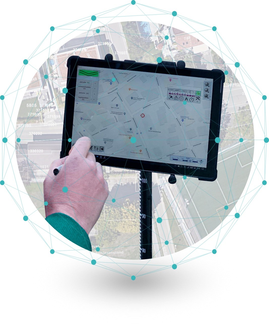
Ready-In-the-field land inventory data collector providing owners and users with a socially attested preliminary title.
Working seamlessly with AIOS Global Navigation Satellite System, AIOS Field Data Collector is incorporating Surveying, CAD, and GIS, to create a seamless digital data flow between field and land management institutions. Specially trained personnel can collect the data while the new web technology allows landowners and users to check their data on a printed, preliminary title of the land inventory for each of their properties, while still in the field.
AIOS Field Data Collector seamless integration of Surveying, CAD & GIS
Key Features
![]() Integrated RTK GPS/GNSS cm accuracy
Integrated RTK GPS/GNSS cm accuracy
![]() Tracing of existing features.
Tracing of existing features.
![]() Based on PostGIS and PostgreSQL databases
Based on PostGIS and PostgreSQL databases
![]() Measurement database to record how each point is measured.
Measurement database to record how each point is measured.
![]() Corridors can be collected, displayed, and set out to automatically.
Corridors can be collected, displayed, and set out to automatically.
![]() Compatible with QGIS
Compatible with QGIS
![]() Rich data structure to record People, Parcels and the relationships between the two
Rich data structure to record People, Parcels and the relationships between the two
![]() Easy to use data entry forms specifically predefined for the requirements in Uganda.
Easy to use data entry forms specifically predefined for the requirements in Uganda.
Maping
![]() Does NOT require an internet connection in the field
Does NOT require an internet connection in the field
![]() Load and Save map cache files to disk
Load and Save map cache files to disk
![]() Works with Geoserver to supply Drone mapping
Works with Geoserver to supply Drone mapping
![]() Produces documentation right in the field while all users and concerned parties are there and can agree.
Produces documentation right in the field while all users and concerned parties are there and can agree.
![]() PDF documentation has PDF security features enabled.
PDF documentation has PDF security features enabled.

Product specifications
 Basic Surveying Functionality
- High accuracy GPS
- COGO
- Graphical method
- Laser Distance Meter
- Total Station
- Integrated RTK GPS / GNSS cm accuracy
- Measurement database to record how each point is measured
- Tracing of existing features
- Corridors can be collected, displayed and set out to automatically
 GIS Functionality
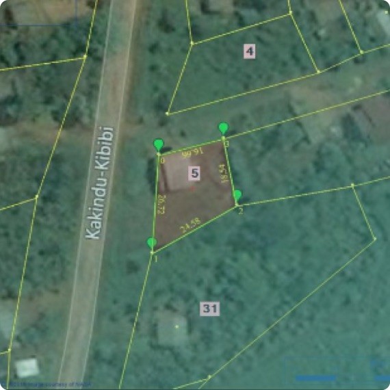
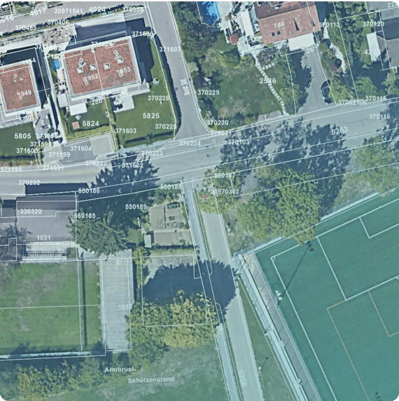
- Point, line and polygon objects
- PostGIS Database Integration
- Mapping Engine (google, bing, yahoo, open street)
- Custom Database & Forms
- Shapefile Import / Export
 CAD Functionality
- CAD Editing
- DXF / DWG Import / Export
 Database Functionality
- Based on PostGIS and PostgreSQL databases
- Compatible with QGIS
- Rich data structure to record people, parcels and the relations between the two
- Easy to use data entry forms specifically predefined for each customer requirements
 Mapping Functionality
- Does not require internet connection in the field
- Load and save map cache files to disk
- Works with Geoserver to supply drone mapping
 Output Functionality
- Produces documentation ready in the field while all users and interested parties are there to agree
- PDF documentation has specific security features enabled